General Navigation and Sites Map
The Infographics panel acts as the platform’s geospatial intelligence core. This environment automatically consolidates official statistical databases, satellite sensors, and real-time monitoring to precisely diagnose external factors (commercial, social, criminal, and environmental) that directly impact the perimeter of the assessed site.

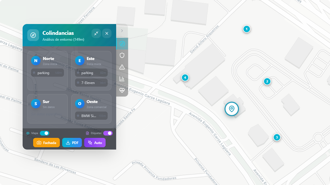
Upon accessing the tab, the platform displays an interactive central cartographic interface that geolocates the study site. Through a dynamic sidebar menu, the security analyst can activate different layers of territorial information. The system has integrated output tools that allow exporting consolidated executive reports in PDF format independently, facilitating the transfer of maps and hard environmental data to external management reports.
Adjacent Areas
This layer allows mapping and auditing in detail the surrounding establishments organized strictly by cardinal points (North, South, East, West).
- Operational Purpose: Its main objective is to identify the commercial, residential, logistical, or industrial nature of the immediate perimeter within a predetermined analysis radius.
- Risk Assessment by Adjacent Zones: Allows the Security specialist to foresee vulnerabilities transferred by adjacency (such as the presence of vacant lots, unsupervised public parking, or high-turnover commercial establishments) that could compromise the physical security of access points or the organization’s privacy.