
This sociodemographic diagnostic layer processes institutional population and development statistical databases (such as data from CONAPO and CONEVAL).
-
- Territorial Development Indices: Visually maps the municipal marginalization index, population volume, and the percentage of multidimensional poverty in the area surrounding the facilities.
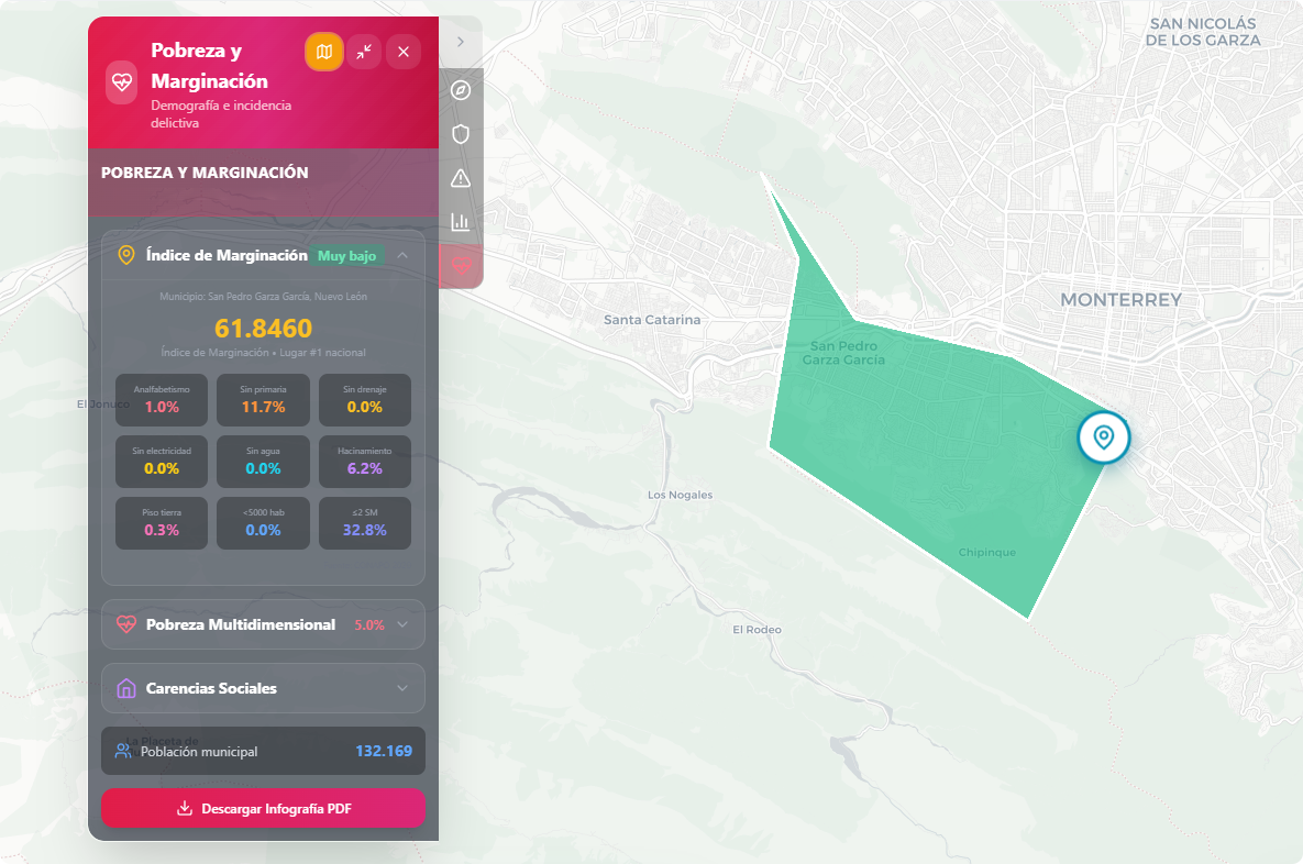
- Social Data: Allows reviewing socioeconomic vulnerabilities of the environment. This analysis is fundamental for understanding the social context to design community engagement strategies and mitigate risks associated with social conflicts or vulnerable environments.