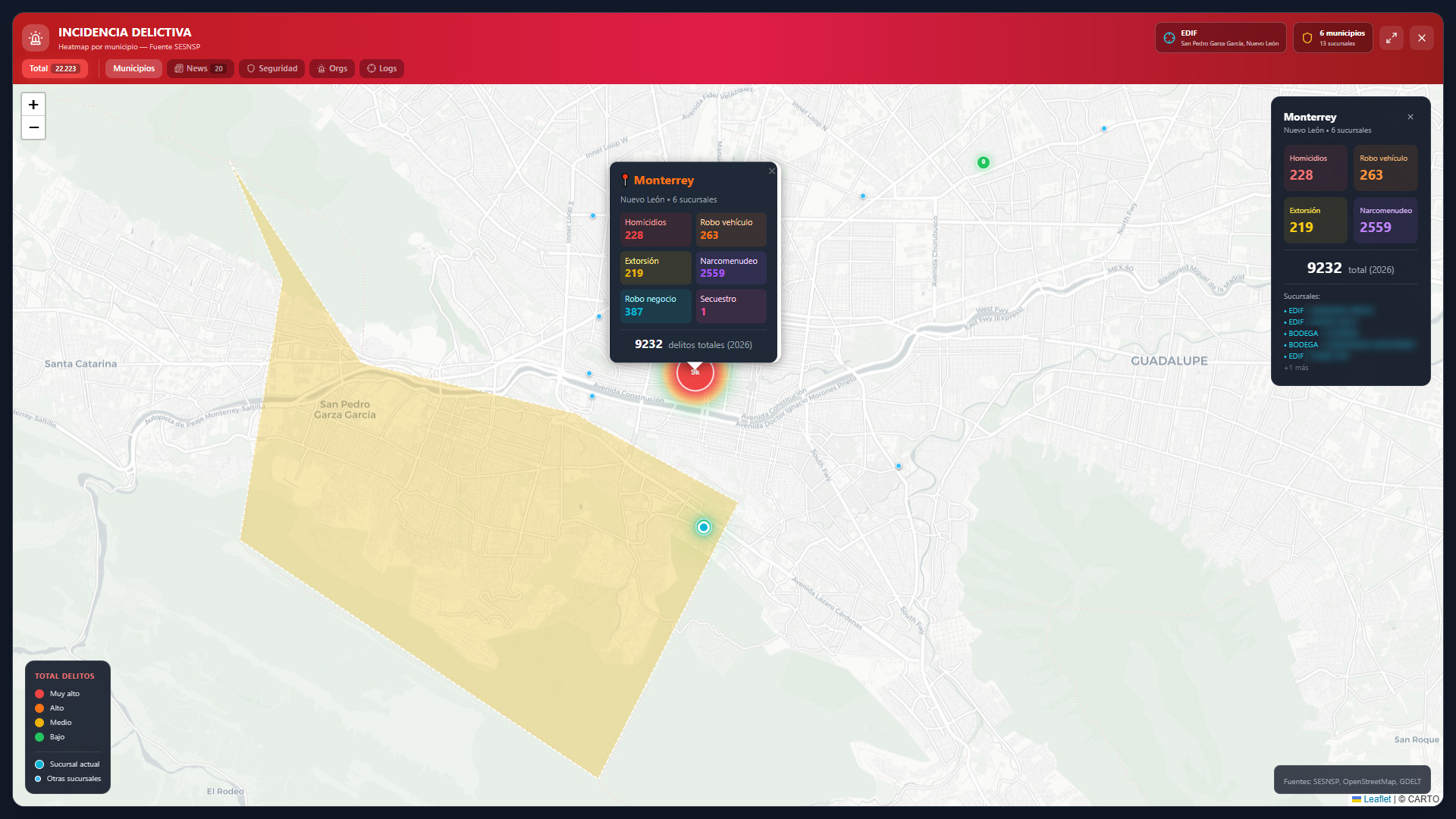
This module combines georeferencing with open-source intelligence analysis (OSINT) through a dynamic criminal incidence Heatmap at municipal and regional levels:
-
-
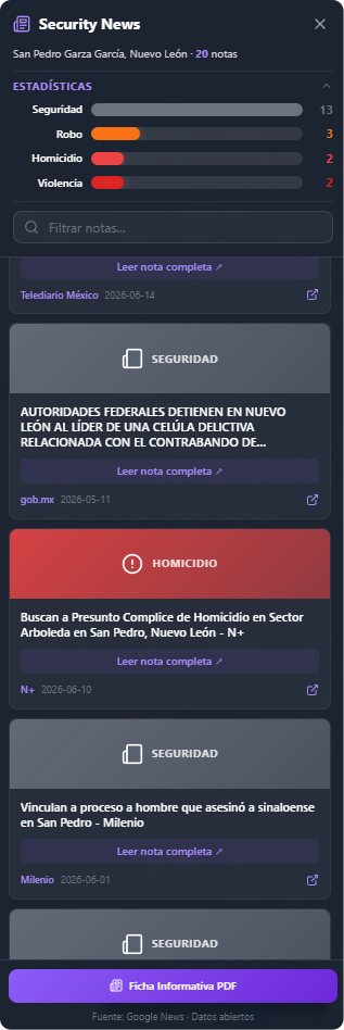
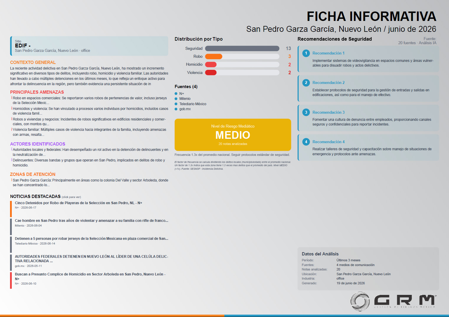
- Security News (Press Scanning): By clicking the News button, the system extracts a breakdown of relevant news and informational notes from the study area. The system automatically categorizes news by crime type, showing the headline, publication date, media source, and a direct link for full reading.
-
The PDF Info Sheet button allows immediate export of the criminal analysis of the selected area to a PDF output file.
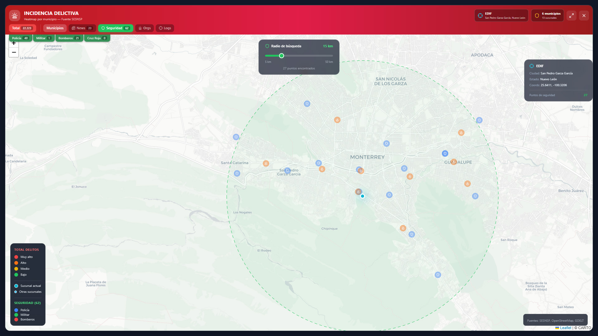
- Security Resources with Route Tracing: Allows establishing a dynamic search radius (from 5 km to 50 km) to identify security and assistance points in the search area (Police, Military, Fire Department, Red Cross).
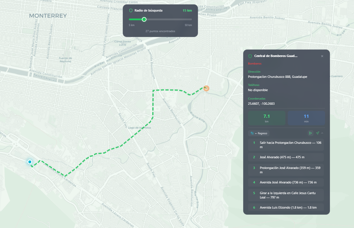
When selecting a resource, the platform enables the route tracing function for emergency dispatch.
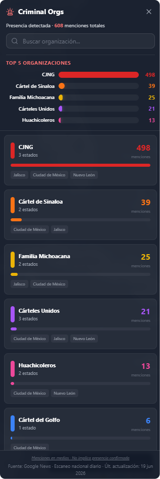
- Criminal Organization Mapping (Criminal Orgs): An intelligence layer that tracks and identifies the presence and volume of media mentions of different cartels, criminal cells, or organized groups with registered activity in the vicinity of study sites, providing an assessment of the real threat landscape in the territory.
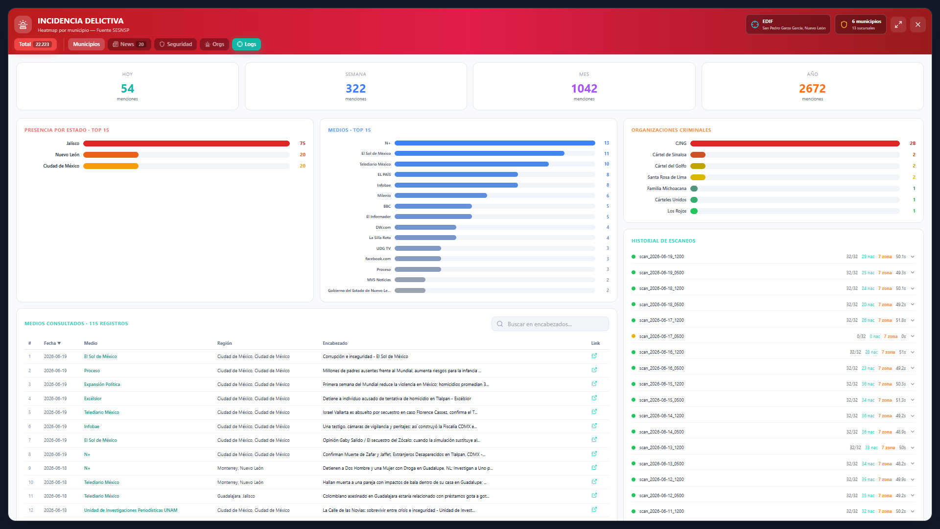
- Scan Log and Statistics Engine: A technological transparency panel that shows the history of automatic executions of the data extraction algorithm. It records the frequency of queries (by day, week, month, and year), the media sources consulted, and the volume of mentions detected about criminal organizations and criminal events, ensuring the update and integrity of the statistics that feed the platform.